WWII North Pacific Military Bases
This Google map shows the location of the airfields, naval bases, and various other military installations involved in the war in the North Pacific during WWII. It also shows the airfields used to fly Lend-Lease aircraft from plants in the United States to the Soviet Union.
Help using Google Maps
The Full Screen control in the upper righthand corner of the Google Maps display expands the display to cover the entire computer screen. This full-screen feature is not available on Apple IOS devices like the iPad.
You can exit out of full screen by pressing the Escape key or clicking the control in the upper righthand corner of the display.
The Map/Satellite control in the upper lefthand corner of the screen lets you choose either the normal map view or the satellite view. The satellite view allows you to see the actual military facility when you zoom in. You can choose to turn Labels on or off. The labels are the names of places, businesses, cities, etc. that appear on the map. You can turn off the labels if they obstruct your view.
When you select the Map view, you can turn on terrain features by clicking or touching the Terrain box. This will show things like mountain ranges, similar to looking at a relief map.
You can zoom in and out in a few ways. If you're using a mouse with a scroll wheel, the wheel controls zooming. If you're using an IOS device like an iPhone or iPad, double-tapping the display zooms in but tapping does not zoom out.
Most touch screen devices will zoom by pinching the display with two fingers.
Lend-Lease
The United States had to supply its ally, the Soviet Union, with a huge amount of armaments and supplies during WWII to fight their common enemy, Nazi Germany. German and Japanese submarines made shipping by sea very risky. The U.S. instead flew aircraft from plants in the United States to the Soviet Union. The above map shows the airfields that were used.
The yellow markers are the plants where the aircraft and their components were manufactured. They were flown from the plants to Great Falls where they were outfitted and had the Soviet Red Star insignia painted on. Then they were flown north through Canada. The purple markers show the Canadian airfields where these planes stopped to refuel or for repairs. Once they crossed the border into Alaska, they were delivered to Ladd Field in Fairbanks, where the Soviet pilots took delivery of the aircraft.
Why not have the Soviets take delivery in Nome, which was 500 miles closer to Siberia? Because Nome was more vulnerable to attack by the Japanese.
The Soviet pilots flew the rest of the way to the delivery points in the Soviet Union. The green markers show the airfields in the Soviet Union where these planes stopped to refuel or for repairs. A small number of amphibian aircraft, such as PBYs, were transferred to the Soviets as part of Lend-Lease. These were flown from Kodiak to Nunivak Island, then on to Anadyr, Russia and on to Magaden, Russia.
The aircraft transferred to Russia were P-39s, P-40s, P-47s, P-63s, A-20s, B-25s, AT-6s, C-46s, and C-47s.
The route between Alaska and Siberia was called the Alaska-Siberia (ALSIB) route that crossed between the North American mainland and Siberia at its narrowest point—the Bering Strait. Of the 8,058 Land-Lease aircraft that were delivered to the Soviet Union from American factories, 74 were lost in the U.S. and 58 went down in Canada and Alaska. There were 42 fatal plane crashes in Siberia.
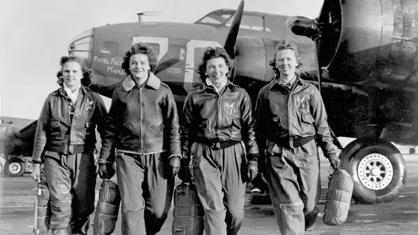
Women ferry pilots flew planes from U.S. plants to a military airfield where they were flown to the Soviet Union by a military pilot (a man). Women ferry pilots flew within the mainland United States only. They did not ferry aircraft across Canada to Alaska.
Internment
American pilots whose planes were shot up over the northern Kuril Islands and didn't feel they could make it back to Attu or Shemya could land on the Soviet Kamchatka Peninsula. However, when they did, they were interned by the Soviets for the duration of the war according to the terms of the Soviet–Japanese Neutrality Pact of April 13, 1941.
The sole airfield in southern Kamchatka was the Yelizovo Airport (aka Petropavlovsk-Kamchatsky Airport)—today named Elizovo Airport. Yelizovo was about 150 miles from the northern Kuril Islands and Attu was 750 miles.